DroneDeploy: Revolutionizing the Way We Survey
Drones have become an integral part of various industries, from photography to agriculture. One company that has been at the forefront of this technological revolution is DroneDeploy. With its cutting-edge software and innovative approach, DroneDeploy has transformed the way we survey and collect data. In this article, we will delve into the features and benefits of DroneDeploy and explore how it has revolutionized the surveying industry.
Streamlining Surveying Operations
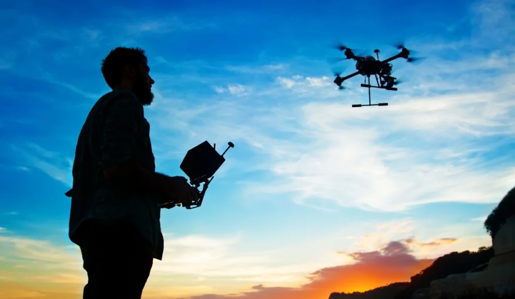
Traditionally, surveying involved manual measurements and time-consuming processes. However, DroneDeploy has simplified this task by providing a comprehensive solution that combines drones, software, and cloud-based data processing. The process begins with the deployment of a drone equipped with high-resolution cameras and sensors. These drones can cover vast areas in a fraction of the time it would take a human surveyor.
Once the drone captures the required data, it is uploaded to the DroneDeploy software. This software utilizes advanced algorithms to process the images and generate accurate 2D maps, 3D models, and orthomosaics. The data is then stored securely in the cloud, accessible from anywhere at any time. This streamlined workflow not only saves time but also reduces costs associated with traditional surveying methods.
Enhanced Accuracy and Precision
One of the key advantages of using DroneDeploy is the enhanced accuracy and precision it offers. The high-resolution cameras and sensors on the drones capture detailed imagery, allowing for precise measurements and analysis. The software’s advanced algorithms then process this data to create highly accurate maps and models.
Furthermore, DroneDeploy’s software incorporates ground control points (GCPs) to improve accuracy even further. GCPs are physical markers placed on the ground whose coordinates are known precisely. By referencing these points in the data processing stage, DroneDeploy can align the captured imagery with real-world coordinates, resulting in highly accurate and georeferenced outputs.
Efficient Data Analysis and Collaboration
DroneDeploy’s software not only processes the captured data but also provides powerful analysis tools. These tools allow surveyors to extract valuable insights and measurements from the generated maps and models. For example, the software can calculate distances, areas, and volumes with just a few clicks, eliminating the need for manual calculations.
Additionally, DroneDeploy enables seamless collaboration among team members. The cloud-based platform allows multiple users to access and work on the same project simultaneously. This feature is particularly beneficial for large-scale surveys that involve multiple surveyors or stakeholders. By providing real-time access to data and analysis tools, DroneDeploy facilitates efficient decision-making and collaboration.
Expanding Applications and Future Prospects
DroneDeploy’s applications extend beyond traditional surveying. The software has found utility in various industries, including construction, agriculture, mining, and environmental monitoring. In construction, for instance, DroneDeploy can be used to monitor progress, identify potential issues, and ensure compliance with design specifications. In agriculture, drones equipped with multispectral cameras can capture data that helps optimize crop health and yield.
Looking ahead, DroneDeploy is poised to continue its growth and innovation. The company is constantly improving its software by incorporating new features and functionalities. For example, it recently introduced artificial intelligence (AI) capabilities that enable automated object detection and classification. This advancement opens up new possibilities for applications such as infrastructure inspection and disaster response.
Conclusion
DroneDeploy has revolutionized the surveying industry by providing a comprehensive solution that combines drones, software, and cloud-based data processing. The streamlined workflow, enhanced accuracy, efficient data analysis, and collaborative features have made DroneDeploy an indispensable tool for surveyors across various industries. As the technology continues to evolve, we can expect DroneDeploy to further expand its applications and transform the way we collect and analyze data.